Public school locations are shown for research, not as assigned schools. Confirm attendance, choice-program eligibility and current grades with the district for the exact home address.
Elementary schools
Nearby schools in the reference point’s district: Snoqualmie Valley School District
Edwin R Opstad Elementary ↗Grades K–5 · Snoqualmie Valley School District1.1 mi from the reference point, straight-line · outside the reference boundary
North Bend Elementary School ↗Grades K–5 · Snoqualmie Valley School District2.2 mi from the reference point, straight-line · outside the reference boundary
Snoqualmie Elementary ↗Grades PreK–5 · Snoqualmie Valley School District4.7 mi from the reference point, straight-line · outside the reference boundary
Charter, alternative & specialized programs (2)
Separate eligibility or application requirements may apply.
Snoqualmie Parent Partnership Program ↗Grades K–12 · Snoqualmie Valley School DistrictAlternative Education School4.5 mi from the reference point, straight-line · outside the reference boundary
Snoqualmie Access ↗Grades PreK–12 · Snoqualmie Valley School DistrictSpecial Education School5.5 mi from the reference point, straight-line · outside the reference boundary
Middle schools
Nearby schools in the reference point’s district: Snoqualmie Valley School District
Twin Falls Middle School ↗Grades 6–8 · Snoqualmie Valley School District1.8 mi from the reference point, straight-line · outside the reference boundary
Snoqualmie Middle School ↗Grades 6–8 · Snoqualmie Valley School District4.5 mi from the reference point, straight-line · outside the reference boundary
Chief Kanim Middle School ↗Grades 6–8 · Snoqualmie Valley School District10.0 mi from the reference point, straight-line · outside the reference boundary
Charter, alternative & specialized programs (2)
Separate eligibility or application requirements may apply.
Snoqualmie Parent Partnership Program ↗Grades K–12 · Snoqualmie Valley School DistrictAlternative Education School4.5 mi from the reference point, straight-line · outside the reference boundary
Snoqualmie Access ↗Grades PreK–12 · Snoqualmie Valley School DistrictSpecial Education School5.5 mi from the reference point, straight-line · outside the reference boundary
High schools
Nearby schools in the reference point’s district: Snoqualmie Valley School District
Mount Si High School ↗Grades 9–12 · Snoqualmie Valley School District4.8 mi from the reference point, straight-line · outside the reference boundary
Two Rivers School ↗Grades 9–12 · Snoqualmie Valley School District4.8 mi from the reference point, straight-line · outside the reference boundary
Charter, alternative & specialized programs (2)
Separate eligibility or application requirements may apply.
Snoqualmie Parent Partnership Program ↗Grades K–12 · Snoqualmie Valley School DistrictAlternative Education School4.5 mi from the reference point, straight-line · outside the reference boundary
Snoqualmie Access ↗Grades PreK–12 · Snoqualmie Valley School DistrictSpecial Education School5.5 mi from the reference point, straight-line · outside the reference boundary
Figures cover the named Riverbend geography. U.S. Census Bureau · ACS 2020-2024
Housing units
634
Detached homes
100%
Owner-occupied homes
92.4%
Median owner-reported home value
$811,100
Median gross monthly rent
$2,767 / mo
Mean one-way commute
32.9 min
Population1,748
Median household income$148,269
Population by age
Total population · n=1,748
0%50%100%
Under 1824.5%
18 to 243.2%
25 to 4431.5%
45 to 6427.1%
65 and over13.8%
View counts and uncertainty
Group
Estimate
90% margin
Under 18
428
± 116.3
18 to 24
56
± 71.8
25 to 44
550
± 136.6
45 to 64
473
± 119.4
65 and over
241
± 109.5
Census ACS 2020-2024 · B01001 · Riverbend
Household income distribution
Households; annual income in 2024 dollars · n=634
0%50%100%
Under $50k8.8%
$50,000 to $99,99927.1%
$100,000 to $149,99915.5%
$150,000 to $199,9998.2%
$200k and over40.4%
View counts and uncertainty
Group
Estimate
90% margin
Under $50k
56
± 52.1
$50,000 to $99,999
172
± 86.9
$100,000 to $149,999
98
± 61.3
$150,000 to $199,999
52
± 37
$200k and over
256
± 81
Census ACS 2020-2024 · B19001 · Riverbend
Housing types
Housing units · n=634
0%50%100%
Detached100%
Attached0%
Multifamily0%
Mobile & other0%
View counts and uncertainty
Group
Estimate
90% margin
Detached
634
± 115
Attached
0
± 13
Multifamily
0
± 31.8
Mobile & other
0
± 18.4
Census ACS 2020-2024 · B25024 · Riverbend
Owners and renters
Occupied housing units · n=634
0%50%100%
Owner-occupied92.4%
Renter-occupied7.6%
View counts and uncertainty
Group
Estimate
90% margin
Owner-occupied
586
± 114
Renter-occupied
48
± 54
Census ACS 2020-2024 · B25003 · Riverbend
How people get to work
Workers age 16+; includes working from home · n=923
0%50%100%
Drive alone63.6%
Carpool13.4%
Public transit1.1%
Walk or bike2.2%
Work from home15.1%
Other4.7%
View counts and uncertainty
Group
Estimate
90% margin
Drive alone
587
± 136
Carpool
124
± 71
Public transit
10
± 18
Walk or bike
20
± 34.5
Work from home
139
± 75
Other
43
± 67.5
Census ACS 2020-2024 · B08301 · Riverbend
Sources, definitions & uncertainty
ACS five-year estimates describe a multi-year period, not current asking prices or a home valuation. Margins of error use the Census Bureau’s 90% confidence level.
Measure
Estimate
Margin of error
Statistical universe
Housing units
634
± 115
Housing units
Detached homes
100%
± 0 pp
Housing units
Owner-occupied homes
92.4%
± 6.5 pp
Occupied housing units
Median owner-reported home value
$811,100
± $55,446
Owner-occupied housing units; owner-reported value, not a sale price
Median gross monthly rent
$2,767 / mo
± $239 / mo
Cash-rent households; includes applicable tenant-paid utilities
Mean one-way commute
32.9 min
± 12.9 min
Workers 16+ who travel to work
U.S. Census Bureau, ACS 2020–2024, retrieved via Census Reporter. Figures cover the entire named statistical geography, including any portion outside King County; the county map is clipped to King County. Derived margins are approximations. Unavailable published margins, including controlled estimates, remain unavailable. ZIP figures describe Census ZCTAs; CDPs are statistical areas, not municipalities.
The trail crosses the South Fork Snoqualmie River in Riverbend along the valley's historic rail corridor. This shared non-motorized route uses designated entrances; adjoining residential land remains private.
Riverbend appears in the U.S. Census Bureau’s designated-place geography. The outline is a statistical reference, distinct from a homeowners association, school district or parcel boundary.
ACS 2020 to 2024 estimates report 1,748 residents and 634 housing units for the full Riverbend CDP. Detached homes represent 100.0% of housing units, and 92.4% of occupied homes are owner-occupied. Read the charts and published margins together.
EPA 2021 index at the reference point: Riverbend boundary reference point. These are the reference point’s Census block group ranks, not a score for every home or the whole neighborhood.
Reference boundaries, statistical geographies, school attendance and property parcels are distinct. Confirm the actual address and source vintage.
Snoqualmie Valley Trail river crossing
The trail crosses the South Fork Snoqualmie River in Riverbend along the valley's historic rail corridor. This shared non-motorized route uses designated entrances; adjoining residential land remains private.
Riverbend appears in the U.S. Census Bureau’s designated-place geography. The outline is a statistical reference, distinct from a homeowners association, school district or parcel boundary.
ACS 2020 to 2024 estimates report 1,748 residents and 634 housing units for the full Riverbend CDP. Detached homes represent 100.0% of housing units, and 92.4% of occupied homes are owner-occupied. Read the charts and published margins together.
The same ACS period estimates a mean one-way journey of 32.9 minutes among people who travel to work; 15.1% of workers age 16 or older worked from home. These are period estimates across the named geography, not a prediction for an individual address.
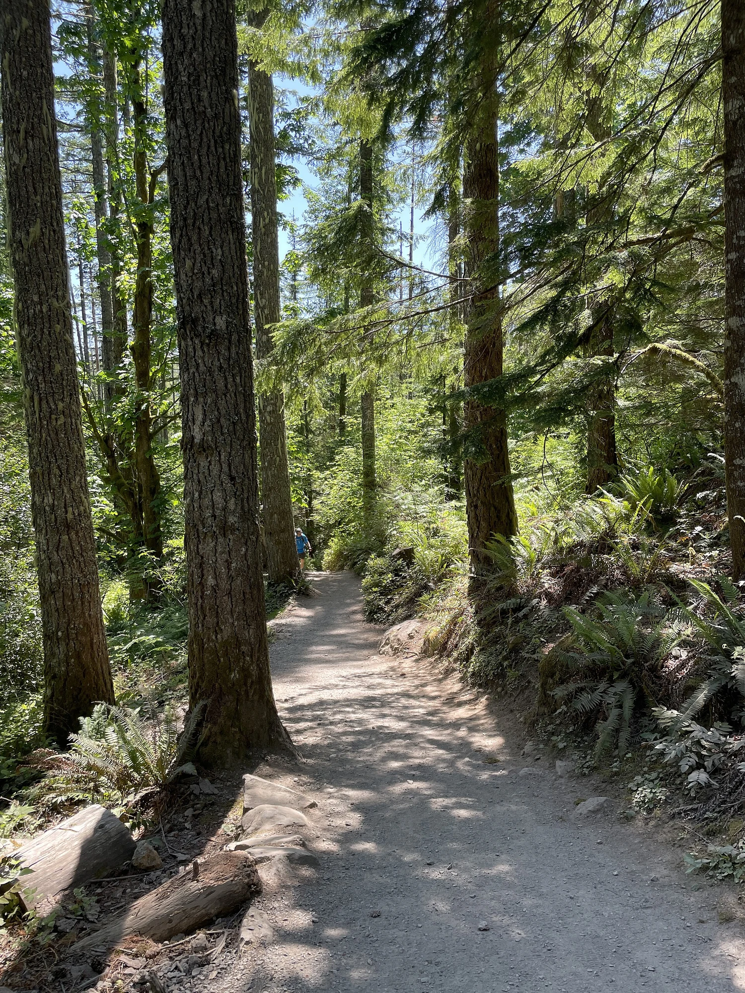
ⓘWooded path on the Rattlesnake Ledge Trail, June 2023
Take the guide outside.
Walk the routes you would use, visit at different times and compare the details at each property. A neighborhood overview cannot replace seeing the actual home.
Try your own routes at the times you travel.
Check parking, street conditions and access at the property.
Verify school assignment with the district for the exact address.
Separate the area’s amenities from access offered by the home.
Before you shortlist.
Does this guide define an official boundary?
No. Neighborhood names and official planning areas may differ. Use the cited sources and the specific parcel when a boundary matters.
Can I use the guide to confirm a school assignment?
No. Check the property address directly with the relevant district. Proximity to a campus is not a guarantee of enrollment.
Where can I discuss homes in this area?
Contact Ryan with your area, timeline and priorities. This guide describes the area; check current listings separately.
Pair this local guide with these broader home-buying perspectives, then verify the details for a specific address. Historical reports describe their original publication period.